Antique hotsell Grand Canyon, Arizona 1962 US Geological Survey Topographic Map – Kaibab National Forest, Navajo, Mohave, Colorado River Coconino AZ
Beautiful massive antique map of the Grand Canyon and surrounding.
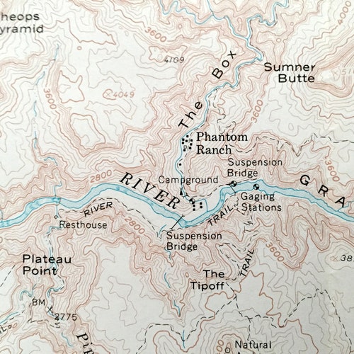
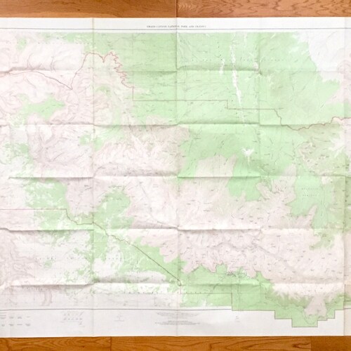
Beautiful, massive, antique map of the Grand Canyon and surrounding Grand Canyon National Park, Kaibab National Forest, Grand Canyon-Parashant National Monument, Hualapai Indian Reservation, Havasupai Indian Reservation and the Navajo Nation of Arizona. This is an authentic 1962 edition, 1975 print from the U.S. Geological Survey and NOT a computer reproduction.
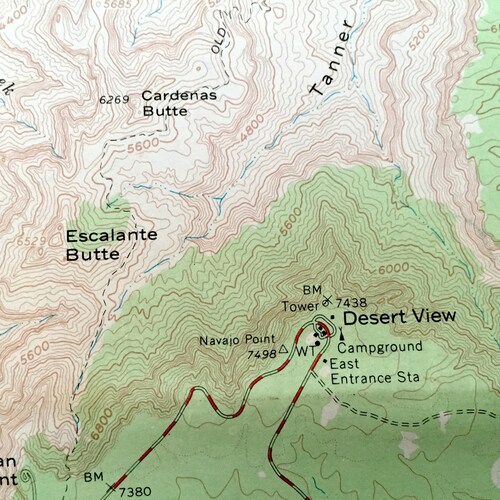
The USGS only printed a small number of these maps centered around specific geological points of interest. The entire Grand Canyon is pictured. In a normal USGS map it would be divided into many smaller maps because of its immensity. It is one of the largest maps in my collection and is frankly stunning in its presentation and detail since it is still at 1:62500 scale. This map will be the centerpiece and focus of whatever room it is hung in. (See quarter in bottom left corner to get an idea of scale.)
See what the majestic Grand Canyon looked like more than 55 years ago. Lots of intricate details and geological contours. Map even has little squares for every house and building that existed at the time. The USGS hotsell cartographers were very thorough back then!
Perfect for the historian, map-lover, the curious or just as a conversation starter. Wonderful and rare. Vintage maps such as these make great gifts.
Edition of 1962, printed 1975
Dimensions: 59" width x 37 1/2" height
----
Features
Cities & Towns: Supai, Topocoba Hilltop, Hermits Rest, Grand Canyon, Phantom Ranch, Desert View, North Rim.
Points of Interest: Grand Canyon, Mohave County, Coconino County, Kaibab National Forest, Grand Canyon National Park, Grand Canyon-Parashant National Monument, Hualapai Indian Reservation, Havasupai Indian Reservation and the Navajo Nation Indian Reservation, Colorado River, Little Colorado River, Painted Desert, Coconino Plateau, Kaibab Plateau, Powell Plateau, Walhalla Plateau, North Rim, South Rim, Tapeats Amphitheater, Bright Angel Canyon, Granite Gorge, Hindu Amphitheater, Marble Canyon, Palisades of the Desert, Havasu Canyon, Fossil Bay, Great Thumb Mesa, Conquistador Aisle, Sage Brush Point, Hundred and Fifty Mile Canyon, Havatagvitch Canyon, Kanabownits Canyon, Cocks Comb, Walhalla Glades, Buck Farm Canyon, Hualapa Canyon, The Box, De Motte Park, Alarcon Terrace, Explorers Monument, Shiva Temple, Mather Point, Grandeur Point, Yavapal Point, Ottoman Amphitheater, Holy Grail Temple, Shinumo Amphitheater, Sinyala Mesa, Darwin Plateau, Sagittarius Ridge, Big Saddle, Antelope Point, Lava Canyon Rapids, Blue Moon Bench, Tatahatso Point, Eminence Break, Cape Royal, Bright Angel Point, Sumner Butte, Cope Butte, Fisk Butte, Heather Wash, Keyhole Natural Bridge, Big Saddle Camp, Thunder Cave, Steamboat Mountain, President Harding Rapids and many more canyons, mesas, buttes, rapids, washes, rivers, lakes, springs, points, trails, campgrounds, caves, valleys, amphitheaters, hills, towns, roads and train tracks.
Condition: Very Good Vintage condition, commensurate with age. This map is in incredible shape for being over 40 years old. Has some light edge-wear and folds as-issued, but these will flatten easily and all will read as vintage character when framed.
----
We will happily adjust shipping price for multiple purchases. Maps are rolled up and shipped in sturdy mailing tubes, never folded.


